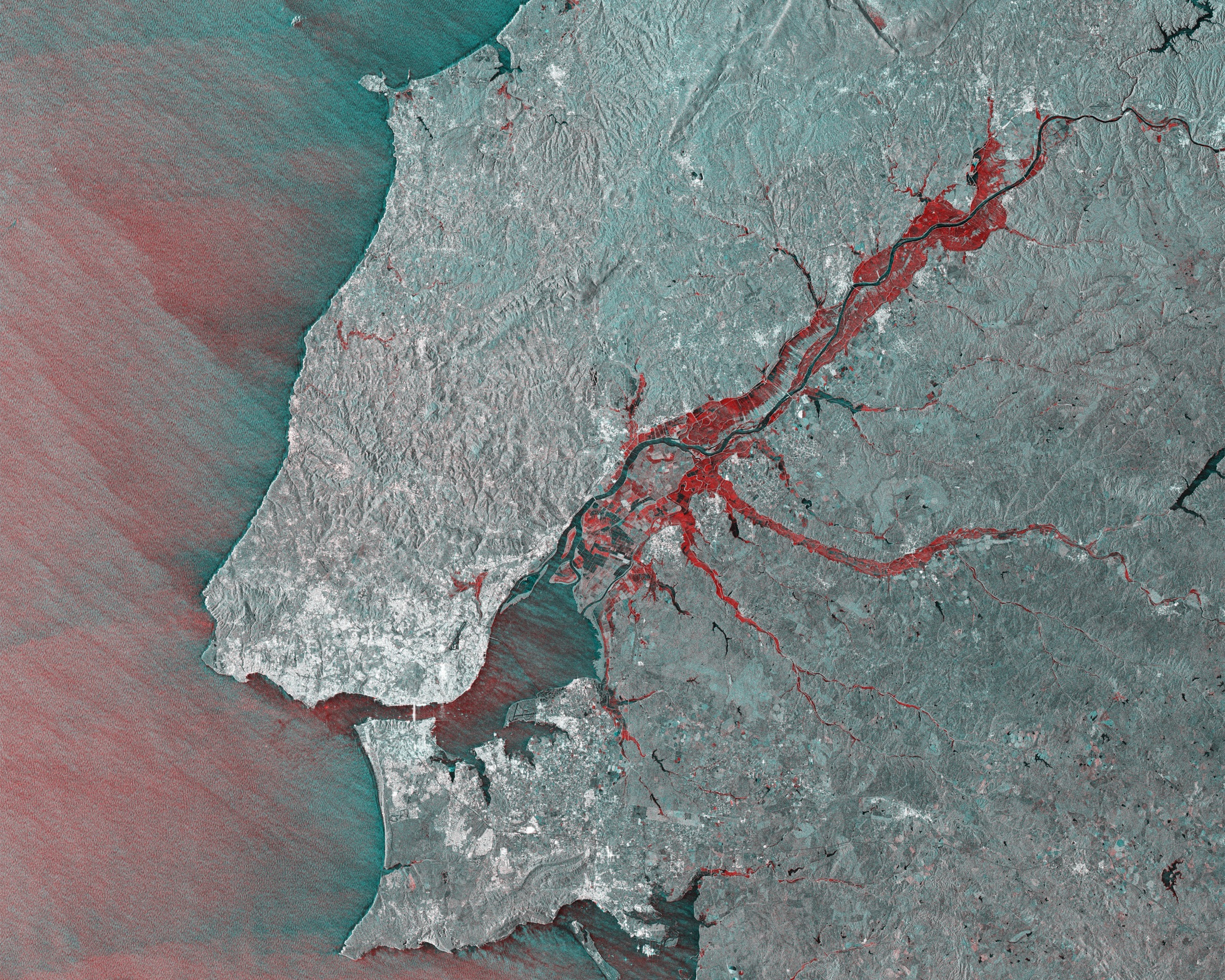
An insurer buys the flood map. Water goes where it goes; the satellite reads its extent and depth against last week’s dry ground; a claims team starts settling on the change between the two. This is Earth observation’s oldest commercial market and still one of its largest: natural catastrophe, the flood edge and the burn scar, change measured against the world’s own past and paid for in real money. It is where the industry learned what its product was, and any reader who has sold into insurance is already holding the objection. Change sells, demonstrably. So the premise that it does not must be wrong.
Point the same instrument at a methane plume and the objection collapses. The sensing is the best in the history of the field. Carbon Mapper’s Tanager-1 published more than five thousand methane plumes in its first year in orbit; Sentinel-5P has read methane daily across the whole planet for the better part of a decade. The United Nations routes what they see to the operators and governments responsible: more than three and a half thousand alerts across thirty-three countries. Around one in eight draws any response at all. The documented cases where a leak was actually stopped number a couple of dozen. Same physics, same quality of observation, and almost nothing moves. The change is visible to anyone who cares to look. There is no market in it.
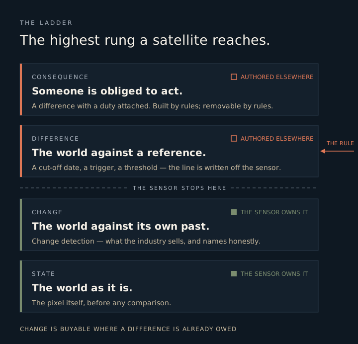
The industry’s own vocabulary already carries the distinction, honestly, and has for years. It sells change detection. Nobody sells difference detection, because a satellite cannot produce one. A satellite sees state, and it sees change: the world now against the world before, its own past the only reference it holds. A difference is something else. A difference is the world held against a rule about what should have been there, and that rule is authored somewhere off the sensor. Tree loss becomes deforestation only through a cut-off date. A water height becomes a payout only through a trigger someone wrote. And a plume is a violation only where a regulation has fixed the line it crosses. The satellite computes the change on either side of the line. It cannot supply the line.
So there is a ladder under all of this. State is the bottom rung, the world as it is. Change is the next, the world against its own history, and the highest a satellite reaches on its own. Difference is the rung above, the world against an external reference, the first rung the instrument cannot reach without help. Consequence is the top, a difference someone is obliged to act on. Change is temporal and the sensor owns it. Difference is normative and someone else owns it. Almost everything the industry finds hard to sell is a change stranded a rung or two below a difference nobody has authored.
Which resolves the flood. Natural catastrophe was never change selling on its own strength: it is the one domain where the difference machinery was built centuries before the satellite arrived. The policy wording already defines the covered loss. The federal disaster declaration already turns on damage thresholds someone wrote down. Liability already accrues by the hour. The satellite drops into a structure thick with pre-existing references and consequences, and the change it measures is instantly a difference somebody owes. The proof sits inside the market itself: the pure disaster map is free. Copernicus gives its rapid-mapping flood extents away on activation; Maxar opens its post-event imagery to anyone. The picture itself costs nothing. What an insurer pays ICEYE for is that same change wired into a claims process where a number is owed, at a speed and a building-level precision the free map cannot match. Change is buyable exactly where a difference is already owed, and close to worthless where it is not.
Go one rung further down and the instrument’s real job comes clear. What a reference-holder actually needs is to know the presence or absence of a difference across a whole population at once, uniformly, the same comparator applied everywhere. That is why references reach for satellites when they want universality rather than a sample: the Common Agricultural Policy now monitors Europe’s farm parcels against the same satellite yardstick, not a field visit here and there. It is also why the jobs generalise. The same act, whether a thing is in breach of the reference or not, everywhere and on identical terms, recurs across deforestation, subsidy control, emissions, sanctions, wherever a rule needs uniform enforcement.
Deforestation ran the whole experiment in sequence, in public. Free satellite alerts for forest loss have existed since 2016; for the better part of a decade they flowed to anyone who registered, and they built almost no market, because a change in a forest obliged no one. Then a regulation authored the reference: a date, the thirty-first of December 2020, written into European law, before which forest loss does not count and after which it does. Two parcels with an identical decade of clearing, one cut in 2019 and one in 2021, became legally opposite overnight. Same pixels, same change, opposite compliance. A paid market began forming around the very images that had been free and inert for ten years. It began forming before the regulation even takes effect at the end of 2026, on the authored reference alone. The satellite gained no new capability. Someone wrote down a “from what”.
And the reverse is happening now, live, on the methane side. The sensing improves every year while the reference is being un-authored. The one American rule that ever named satellite detection directly, the super-emitter provision with its hundred kilograms an hour and its five-day clock to respond, sits deferred to 2027, and underneath it the legal foundation is being pulled out. The finding that let the government regulate greenhouse gases at all was formally rescinded this year and is now in front of the courts. The plumes stay exactly where they are on the screen. The violations they used to be are dissolving above them. Nothing about the observation changed. The obligation did, and the market for the observation moves with the obligation, not the plume.
I came up thinking the work was the change: what changed, what burned, who was under water, and how to quantify it defensibly. That instinct was right in exactly one place, the catastrophe market where the difference was owed before any of us arrived, and it is the instinct the whole industry mistakes for a general law. It exports a flood-shaped intuition into methane, into biodiversity, into every domain where nothing is yet owed, and reads the silence that follows as a gap in the buyer’s understanding. The buyer understands fine. There is nothing yet to buy.
None of which the change-seller controls. Whoever owns the “from what” decides which changes are worth anything, and that seat is almost never the one holding the sensor. Even in its best market the industry is a spec-taker: ICEYE does not decide what counts as a covered loss; the policy and the regulator do, and the company sells against a line drawn by someone else. The top of the ladder is no safe place to stand either, because a difference with no duty attached is only scenery at high resolution, and the consequence rung can be sawn off politically as fast as it was built. The methane operators are watching it happen to theirs.
The physics lives at the bottom of the ladder, and that is where the industry keeps investing: sharper sensors, faster revisits, another band. The meaning lives at the top, where someone writes down what a change is measured against and who has to answer for it. A satellite will show you, in perfect detail, that something has changed. Whether that change is a difference anyone owes is written where no satellite can look.